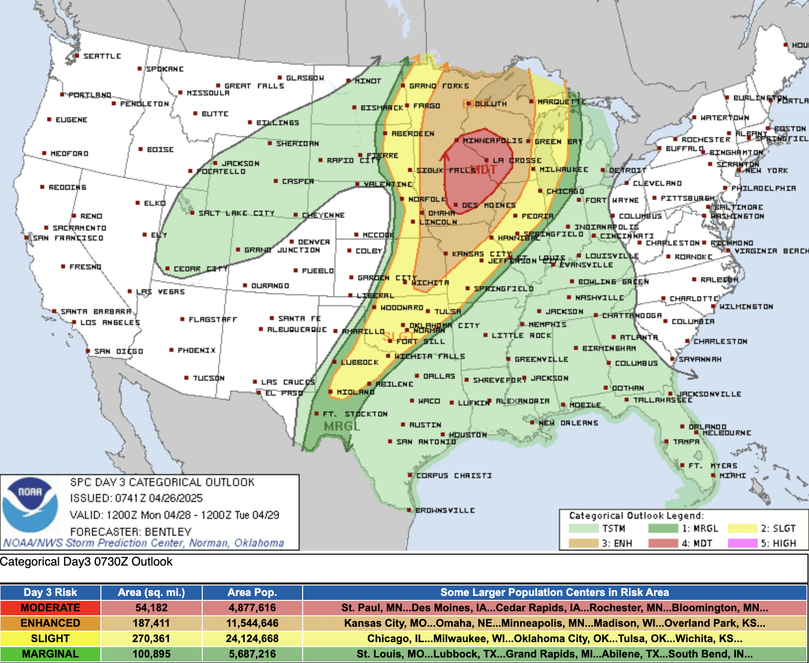
“A tornado outbreak with the potential for strong to intense tornadoes is possible on Monday,” warns the National Weather Service Storm Prediction Center (SPC) — and Minnesota, Iowa and Wisconsin are in the bullseye of where the tornadoes could occur.
That’s where the SPC has issued a level four of five moderate risk for severe storms. Moderate risks indicate a strong likelihood of severe storms capable of producing damaging results, and it’s rare for a moderate risk to be issued three days ahead of time.
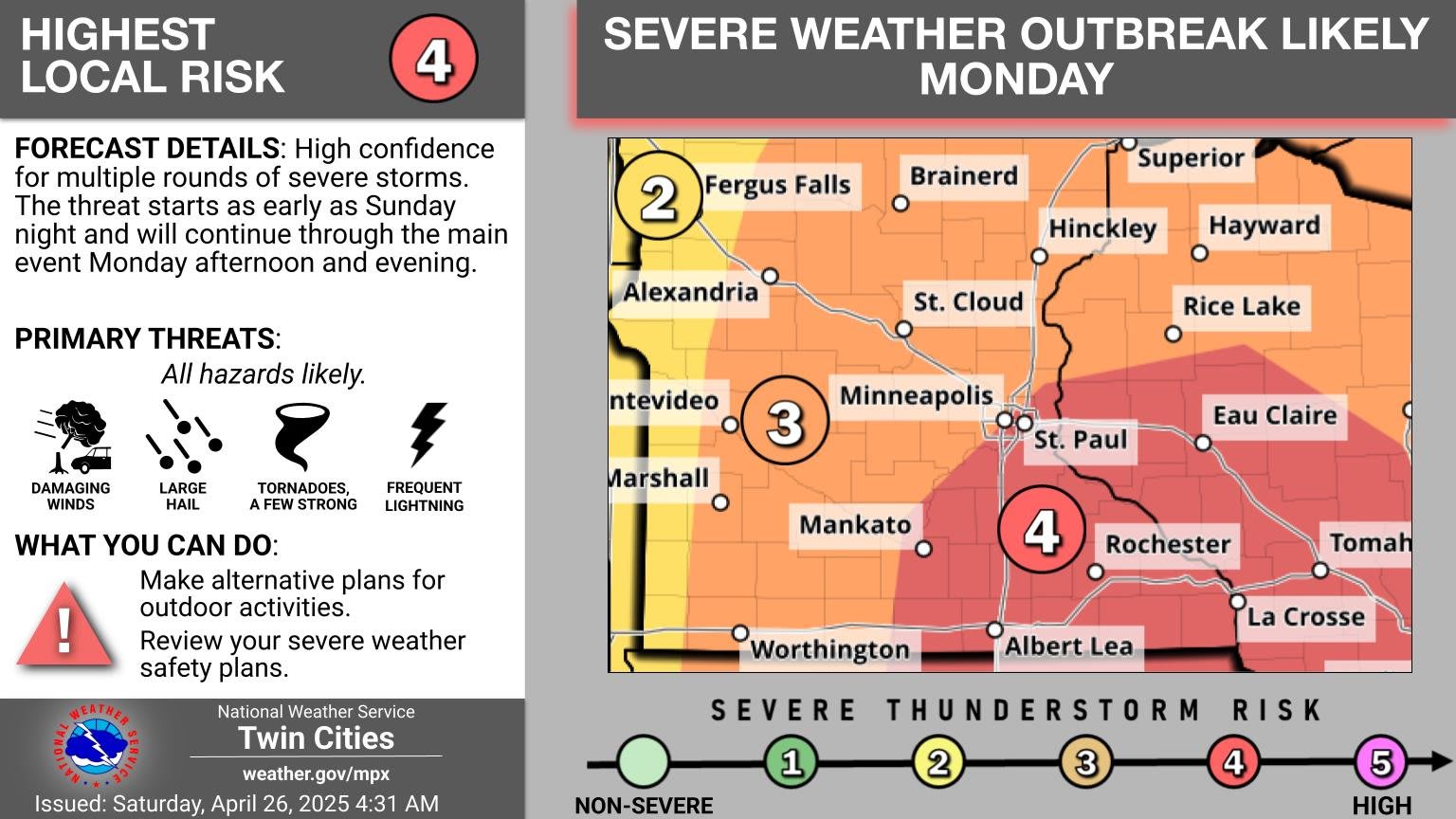
The highest risk zone has expanded north and west and now includes the south and east Twin Cities metro area.
Sign up for our BREAKING WEATHER newsletters
SPC
“A very serious situation is expected to unfold Monday. Scattered supercells capable of strong tornadoes are expected to develop in the Moderate Risk area. It’s rare for such a risk on day 3 anywhere, but especially here,” says Bill Borghoff, a senior meteorologist with the National Weather Service office in Chanhassen.
NWS Twin Cities
“Any supercells which can develop within this increasingly favorable environment Monday afternoon/evening will be capable of strong to intense tornadoes,” the SPC says. “By late evening, a squall line will likely overtake much of the discrete convection as the cold front advances rapidly southeast. Severe wind gusts and embedded tornadoes will remain possible through the late evening and perhaps into the overnight hours.”
The moderate risk area (red on the maps above) is where the strong or intense tornadoes are most likely.
The NWS Twin Cities forecast discussion Saturday morning is calling Monday’s setup one that can produce a “major severe weather outbreak.”
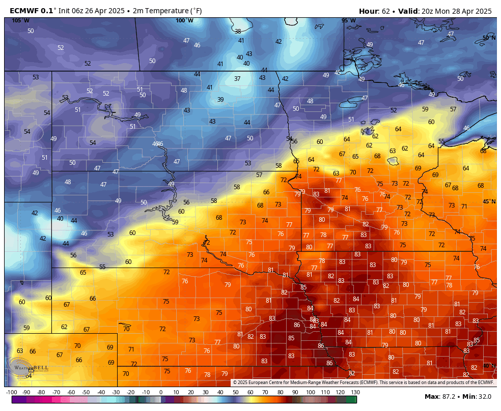
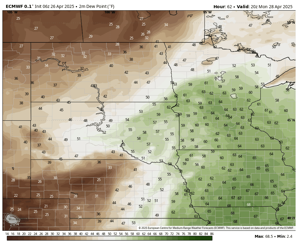
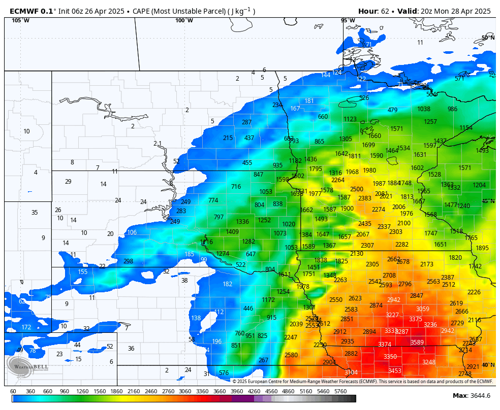
By 3 p.m. Monday, temps will be plenty warm in the 70s and 80s and dew points will be in the mid 60s. There will be more than enough CAPE (Convective Available Potential Energy) for instability and explosive storm development.
WeatherBell
WeatherBell
WeatherBell
The European model’s lightning forecast simulation from 1 p.m. Monday to 1 a.m. Tuesday shows early afternoon development in western Minnesota and intensification as the storms move east toward places like Mankato, the Twin Cities, Rochester, Eau Claire and La Crosse.
WeatherBell
About the author