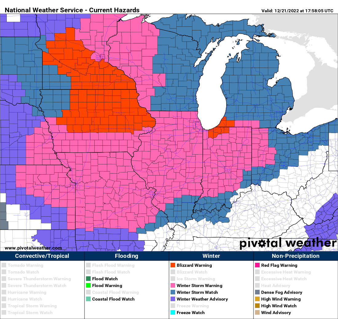
The forecast hasn’t changed but the National Weather Service has decided to extend the blizzard warning that is in effect Thursday and Friday a bit further to the east, now including the southern and western Twin Cities metro area.
Below is the newest warning map, as of 1:30 p.m. The counties that have been added to the blizzard warning are Carver, Dakota, Douglas, Goodhue, Morrison, Rice, Scott, Stearns and Wright, in addition to the entire southeastern corner of Minnesota.
Weather is sponsored by All Energy Solar: get a free installation quote now
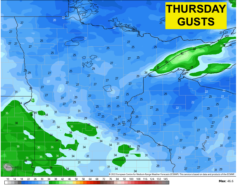
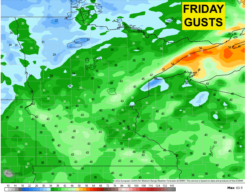
Winds are forecast to increase Thursday and then even more on Friday. Here’s a look at the maximum wind gusts Thursday (left) and Friday (right), according to the European weather model.
Maximum wind gusts
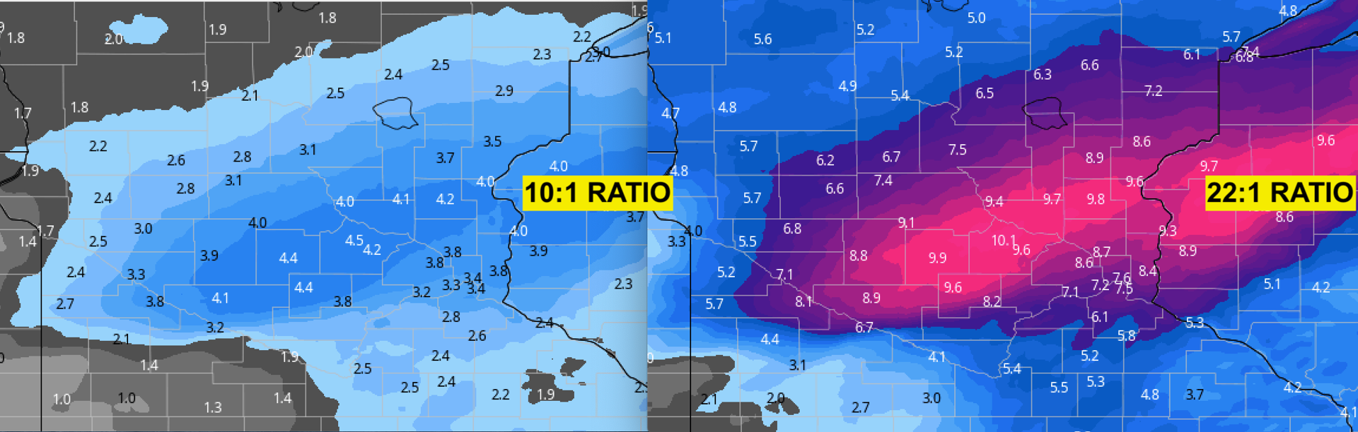
How much snow falls will depend on what kind of ratios exist. The National Weather Service was forecasting ratios of 20+ inches of snow for every inch of liquid, but Bring Me The News meteorologist Sven Sundgaard isn’t seeing ratios that high.
“We’re going to see some heavier snow showers through the afternoon and evening hours and we’re going to start to see that higher ratio of snow,” Sundgaard said midday Wednesday.
A 10:1 ratio would result in a few inches, whereas a 22:1 ratio, which Sundgaard thinks is too high, would put down 8+ inches in the Twin Cities and surrounding areas. That’s why he’s thinking 4-5 inches in the southeastern suburbs with 6-8+ inches in some of the northern suburbs.
Regardless, it’s enough snow to convince cities to issue snow emergencies. Brooklyn Center, Eden Prairie, Richfield, Robbinsdale and St. Louis Park have all issued snow emergencies thus far, and that list will likely grow as the day goes on.
Meanwhile, it’s extremely cold outside and the wind chill will be miserable through Christmas Day. Look at the average wind chill Thursday-Sunday around the state. That’s a -25F “feels like” temp on average through Christmas.
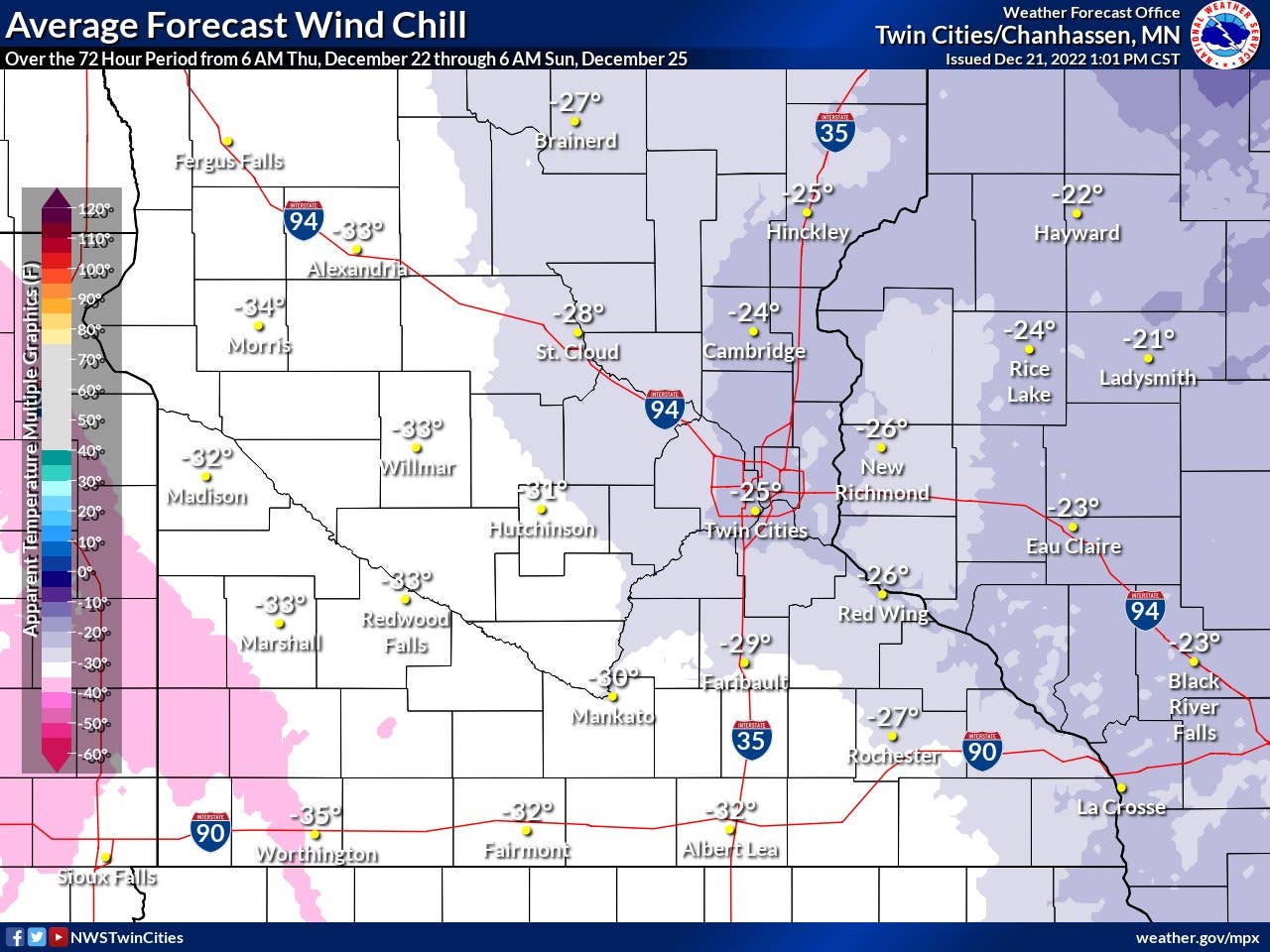
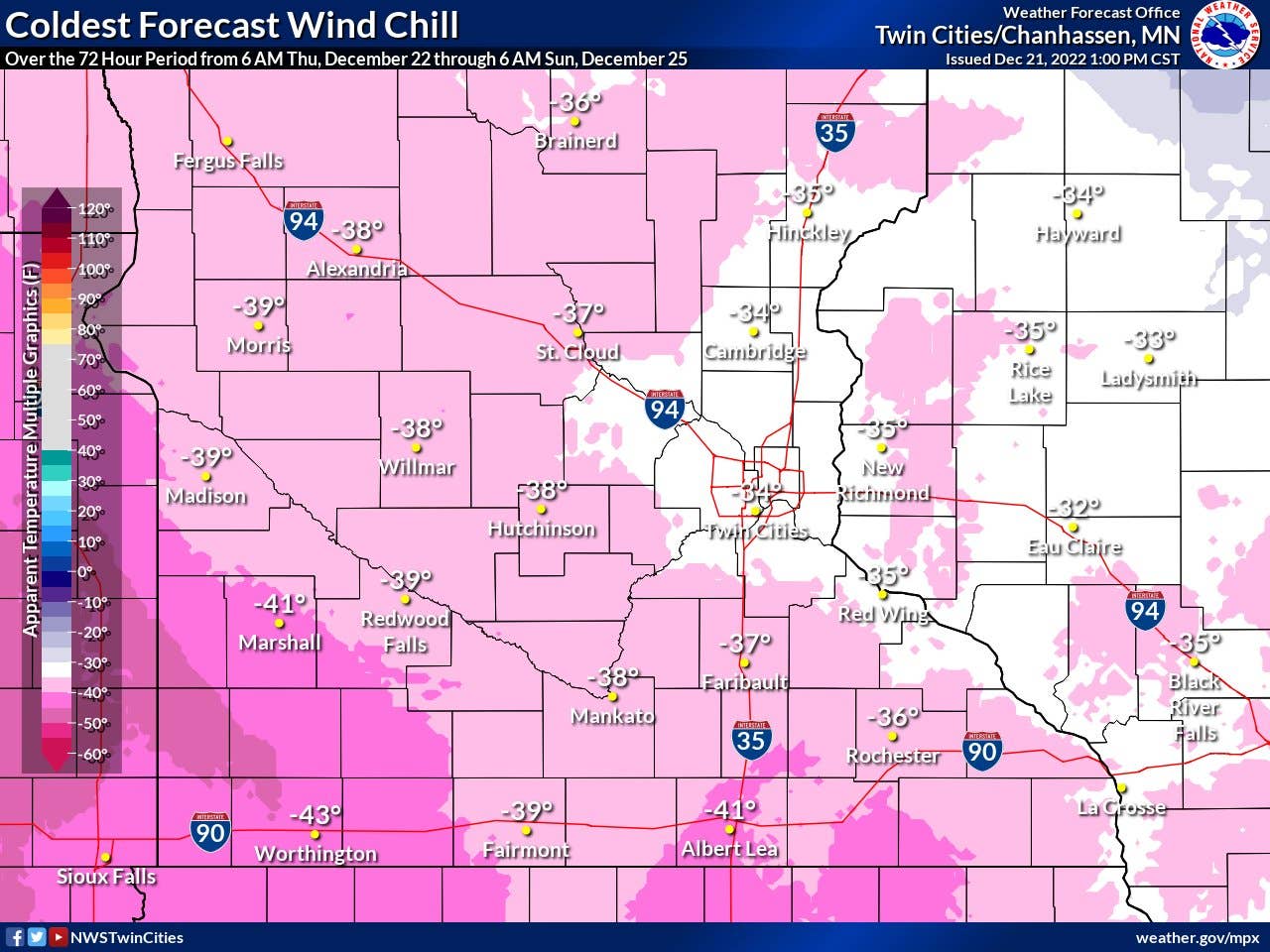
The “warmest” wind chill in the Twin Cities now through Christmas is -17F, per the NWS. The coldest is forecast to be -34F in the Twin Cities, with wind chill readings worse in rural Minnesota.
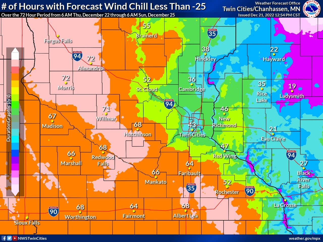
Here’s how many consecutive hours specific places are expected to -25F or colder wind chills. Yep, 43 straight hours of it feeling like -25F or colder in the Twin Cities, and 72 hours straight in Morris and Alexandria. Brutal.
About the author